

Iran Escalates Tensions by Issuing New Strait of Hormuz Map
 Web Desk
|
17 minutes ago
Web Desk
|
17 minutes ago
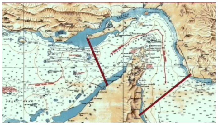
Iran releases a new map showing control over the Strait of Hormuz, escalating regional tensions. The move highlights Tehran’s growing assertiveness in the strategic waterway. The announcement comes amid rising warnings and military signals from Iranian authorities.
The Islamic Revolutionary Guard Corps Navy published the new map, showing a defined boundary in the southern part of the strait. The map highlights a line between Iran’s Kuh-e Mubarak and Fujairah in the United Arab Emirates, signaling a stronger territorial claim.
Previously, Iranian military authorities instructed commercial ships and oil tankers to coordinate with Iranian forces before passing through the Strait of Hormuz. This step increased monitoring and raised concerns among global shipping operators about possible restrictions in the region.
Also Read: UAE exits Opec in major shift to focus on national energy strategy
In addition, Iranian officials warned United States naval forces to stay away from the area. A senior commander from the Khatam al-Anbiya Central Headquarters said Iran fully controls the strait and will respond firmly to any perceived threats.
Meanwhile, tensions have already affected maritime traffic in nearby regions. Reports indicate increased shipping activity at Gwadar port due to uncertainty around the strait. This shift reflects growing concerns among international trade routes passing through the Gulf.
Earlier, Iranian National Security Council chief Ebrahim Azizi warned that any U.S. interference in the Strait of Hormuz would be treated as a violation of ceasefire conditions. Overall, Iran Releases New Map signals a tougher stance that could further heighten regional instability in the Strait of Hormuz.

Pakistan has never compromised on sovereignty, says Bilawal Bhutto
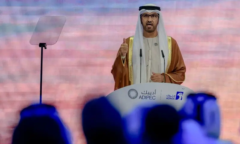
UAE exits Opec in major shift to focus on national energy strategy


17 minutes ago
29 minutes ago
2 hours ago
2 hours ago
3 hours ago
4 hours ago
- Iran releases a new map showing control over the Strait of Hormuz, escalating regional tensions. The move highlights Tehran’s growing…
 The United Arab Emirates’ OPEC departure is not directed at any country, according to the UAE minister heading the state…
- Tensions between Iran and the United States have intensified after Tehran warned that any American interference in the Strait of…
 Vote counting in elections across five Indian states and territories began on Monday under tight security, with major attention focused…


 The Indus Hospital, located in Karachi’s Korangi area, has earned widespread recognition for providing free and quality healthcare services to…
 The Healthcare Devices Association of Pakistan (HDAP) has raised serious concerns over the continued presence of banned reusable syringes in…
- Federal health authorities have ordered strict nationwide enforcement of a ban on conventional disposable syringes and initiated a policy review…
 Pakistan’s second national anti-polio campaign of 2026 is continuing across the country, with efforts now in its sixth day as…


- Iran releases a new map showing control over the Strait…17 minutes ago
- Pakistan seeks India explanation after a significant drop in water…29 minutes ago
- Deputy Prime Minister Reviews Energy Security and ensures an uninterrupted…2 hours ago
- Prime Minister Shehbaz Sharif has sought two-year performance reports from…2 hours ago